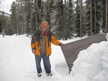
Monday, July 13, 2009

Akamina Ridge - Forum Lake


July 1 and 2, 2009
When I first conceived this epic walk I invited anyone and everyone who wanted to to join me. I have had a couple of family members take me up on the offer. A it was my good fortune to have the company of Penelope my most recent hike.

Since Lorene and I tried to hike into Forum Lake in June of last year I have been wanting to return and make another attempt at reaching the Tri-Boundary Marker. On July 1 and 2 I had that chance.

My friend Penelope and I hiked did this hike. I wasn't sure what to expect in the way of people using Waterton Park on July 1st. I arrived at the Akamina Pass trail head in Waterton Park at about noon. Penelope and I then loaded our back packs and hiked into the Akamina Kishinena Provincial Park in BC. This is a distance of about 2.5 km. To my surprise the campsites in Akamina Kishinena Provincial Park was empty in spite of a high number of hikers and cyclist being on the trail. After a rest and supper there was enough daylight for an evening hike into Wall Lake. This was a about a 5 km hike there and back. The total elevatyion gain on this hike was 179 ft. so it is relatively level. The total hike probably took us 1 and 1/2 hours to complete.

The hike to Forum lake is moderately difficult. It is about 2.5 km into the lake and the elevation gain is 708 ft. Just before reaching the lake we encountered a few small patches of snow that could be avoided, but then there was one area of packed snow that has to be crossed. At the Lake there is a sign marking the trail to Akamina Ridge.

The hike to the ridge is only 1.11 km with an elevation gain of 547ft. There was one avalanche area to cross. It was all packed snow and although it was slippery walking it did not pose a serious obstacle. The second patch of packed snow was on a steeper slope so I chose to avoid it by staying on the tallis on the high side.

We reached the ridge at about 2pm so our hiking time was spent. From where we were the rest of the trail up the ridge seemed a bit daunting to me. I took a photo of it and it is posted in this Blog. I wasn't aware that we could have continued over the ridge and hiked down into Wall Lake. This will be a nice hike to do on a future venture. So we returned the way we came. On the way back we saw a male and a female Blue Grouse. Back at the tenting area we rested a bit and then packed up and hiked out. So the total distance hike on July 2 was about 10 km. which wasn't a bad day for a first time out.

From where we were on Akamina Ridge it was only about 2.2 km further on to the Tri Boundary Marker. But there is another 900 ft. of vertical to do. I also could see from the lake what looked like a contiunous ridge of snow along the ridge. Wheather or not this extended back behind the ridge I could not tell but my guess is that there is a real possiblity that we would have encountered signficant amounts of snow up on the ridge.

Wednesday, June 17, 2009

Willmore Wilderness


Just for the record I had been to the Willmore Wilderness in the summer 0f 1973. I was working for Alberta Fish and Wildlife that summer and for one week I was on a Elk population study in the Willmore Wilderness. However, by Monday June 15, 2009 I had no idea where I had been nor how I got there. So with the help of my topographical maps I endeavored to explore some possibilities. By 10:00 AM last Monday morning I was at the Sulfur Gate Trail head. I found a wide and well used trail that generally follows the East breaks of the Smoky River. As far as I was aware I was the only person on that trail on that day. There were lots of horse tracks and a couple of bicycle tracks but I did not encounter anyone else. The bicycle tracks made me wish that I had my bicycle as although the trail is stony in places I think that I could have traveled further and faster by bicycle.

Less than an hour in and there is a post on the trail, with a moose antler tied to it and an arrow pointing to Eaton Falls. I didn't walk to the falls. A short distance on is Eaton Creek. I would have got my feet wet crossing Eaton Creek if somebody had not thrown down some logs to make a makeshift bridge. There are several places where riverlets cross the trail and there are a few wet areas but all were easily crossed on foot.

After Eaton Creek the trail leveled out considerably. Then about 2 hours into my walk I came to an old burn area. This area seems like the place that I was at in the summer of 1973. I can imagine that the mature scattered aspen trees, there now, were just saplings in 1973. I took the photo in that area.

The area seems to be dry but by afternoon there were some thunderstorms brewing and it did sprinkle rain on me a bit. Not enough to require rain gear. I noted a number of wild flowers in bloom. Wild Strawberry, Dandelion of course, Wood Violet, Blue Eyed Grass, Saskatoon, Purple Violet, False Solomon's Seal, Bain Berry, Lung Wort, and some Peavines and Vetches.

In the interest of time I only allowed myself 2 hours to walk in so I was able to get down the trail 7 km before I turned back. The furthest point that I reached was Henrietta Creek. It was about 1:15PM when I turned back. Although I did not observe any Elk it is likely only because I wasn't looking closely enough. I think this because east of Henrietta Creek the trail was covered with Elk tracks and there was fresh urine also. I could smell them. I expect that they saw me before I saw them and so they move off just as I arrived on the scene.

On the way in I noticed that there was no sign of bears on the trail. On the way out just east of the old burn area there was a big pile of bear poop on the trail. I am sure that if I had taken the temperature of the poop that it would have measured close to the body temperature of the bear.
And so I decided that it was a good time for me to be making a little more noise as I walked along. A bit further along I saw a Ruff Grouse. I think it was a female and that she had a nest or chicks nearby because she wasn't moving far. As I approached she ruffled her feathers and even made a couple of charges at me. "A lot of pluck in that mother" I thought. I'm just happy it was a momma grouse charging at me and not a momma bear.

So this bit of a hike got me within 49.2 km of Intersection Mountain but better than that I got to revisit an area that I had been to decades before.

Stats:
Total distance about 14 km
Total time about 4 hours.
My moving average 3.8.km/hr.
Maximum elevation was 3511 feet.
Total evelation gain was 727 feet.

Kakwa Park, BC and Bastille Creek

The Rocky Mountain Range exits Alberta at Intersection Mountain. So for me to walk the entire Rocky Mountain Range would require that I climb Intersection Mountain. This is the most daunting aspect of such a hike. The reason is that Intersection Mountain is remote. To its east lies the Willmore Wilderness and West of intersection is Kakwa park. I have considered access to Intersection mountain from both east and west. Topographical maps show that the closest access might be from the BC side. I am hope to find a trail that follows Bastille Creek up into the Sheep Pass. There is no trail marked on my 1:250,000 map but I still think there might be one. On June 14, 2009 I finally had a chance to visit the area see what was there for myself. To get there I turned north off of Highway 16 onto a forestry road that is the only access that I know of into Kakwa Park. This road would also get me into the vicinity of Bastille creek. However I only got 12 km down the forestry road and found that the road was flooded at Humbug Creek. I thought it prudent at that point to not proceed on any further. My next option was to explore access through the Willmore Wilderness. That will be my next entry.

Sunday, April 5, 2009

Hawrelak Park

Today I did a hike in Hawrelak Park with the Fit and Active 55 Plus Meet Up group. We started from the Pavilion and walked to the foot bridge across the North Saskatchewan River on the foot bridge. Then we walked generally north in the 'off leash dog walking area' to the first coulee. We walked up that coulee trail a ways and then turned back. The foot bridge is clear of snow but most trails are not. There is considerable slush on the trails. Also welt water is starting to form into ponds which necessitate detoring. That said though walking is not particularly difficult. The branch of the trail up the coulee is currently covered in one place by a foot or so of ice. The surface of the ice is slushing enough though to make it not very slippery and thus walkable. Observed crows, gulls, canada geese and even a pair of Mallard ducks.

This walk was about 5.5 km and took about 1hr and 20 min to complete.

Friday, December 26, 2008

Ski Into Cameron Lake

On December 21, 2008 I drove up the Cameron Lake road and Cross Country skied about 1.77 km into Cameron Lake. Just before I started my skiing another vehicle pulled in. It was 3 people going alpine ski touring. I struck up a conversation with them and asked them about hiking into the Tri-Boundary Marker. They have hiked to it before. The information that they gave me is that if you hike west of form ridge the climb is nothing more than scrambling up the rocks to an exposed ridge which can be followed to the marker. If you go east of Forum Lake it is more of a climb but it can still be done without mountaineering equipment.

Carthew Lake

On November 3, 2008 I picked up Ken and we drove to Waterton Park. It was my intent to attempt a hike up to Forum lake and even perhaps as far as the Tri-Boundary marker. But when we arrived in Waterton we found the road to Cameron Lake was closed. After considering our options we settled on hiking from Cameron Falls to Carthew Lake. Therefore, another attempt to hike to Forum Lake was unsuccessful.


Here are the statistics of the hike:
Distance hiked, note this is to Carthew Lake only, not there and back, My GPS showed 10.97 km (not accurate), Topo Map shows 7.25 km (this seems not far enough), Mapsource Map shows 9.5 km (I think this is the most accurate). The total distance would have been about 19 km.
Time to hike in 3 hr. 11 min. moving 1 hr 39 min stopped time. Total 4 hr 50 min. I estimate that it took about 3 hrs to hike out. So the total time hiking would have been 6 hrs 20 min.
Moving average, in only, 3.4 km/hr.
The GPS shows the elevation difference was 3168 ft but the map shows it as 2800 ft. The map is more accurate.

Tuesday, October 21, 2008

In The Aftermath Of Summer

Finally a moment to update my blog.
I decided to work at the Ukrainian Village for the entire summer. That included fulltime work for the months of May, June, July, and August and part time work in September and October and it precluded any epic walks. However, I have not been idol nor have I abandoned the idea of an epic walk. And I did manage to do a little walking in the Rocky Mountains and a couple of the National Parks.

At the end of June I joined my Grandson and his school class on a hike up to Crandle Lake in Waterton National Park. Later the same day I did a short solo hike on the Akamina Pass trail and attepted to hike the cutline that marks the Alberta - British Columbia boarder. About 1 kilometre south on that cutline I enountered enough snow to discourage any attept to go further. The following day my sister joined me on a hike to Forum Falls and an attempt to get to Forum Lake, which is just across the boarder into BC. We got about half of the way to Forum Lake and encountered too much snow cover to proceed. I did however get a look at Forum Ridge and I must say that a hike on that ridge to the Triboundary Marker does seem to be a bit daunting. It may take more than one attempt to even obtain that. But that is where I hope for any epic hike that I take to either end or begin depending on which end of the Rockies I decide to start on.

This past summer I obtained 1:50,000 scale topographical maps for central Alberta. This includes the maps of the Wilmore Wilderness. I located the point that I would like to be the other end of and epic hike that I were to take. It is the point where the Rocky Mountain Range leaves Alberta. As it turns out that point is the top of Intersection Mountain. At around 8000 feet it is not a high mountain by any means but still remote and promises to be an arduous hike to say the least. I will certainly need to seek some guidance before attempting that portion of the hike.

Through the course of the summer I have enjoyed a number of short morning, afternoon and evening hikes in the Cooking Lake - Blackfoot Recreational Area, and Elk Island Park. I hiked around Tawaik Lake and to and from Oster lake in Elk Island National Park.

Early in July I was on my way to Prince George, BC but a mudslide on the Yellow Head Highway stopped my progress so I was forced to spend the day in Jasper. I took that opportunity to drive up to Mount Edith Cavel and I did the 1 hour hike to view the Angel Glacier. I then hiked a bit of the lower end of Malign Canyon and took a nice walk along Patricia or Pyramid Lake, I'm not sure which it was.

In September two of my brothers and I did a mountain hike just outside of Prince George, BC to what is called The Farm. We rented a cabin for 3 nights. We spent one day hiking the ridge and summited two of the mountain peaks. Not high peaks, the highest being 6200 ft.

My plan now is to arraing my affairs next summer so that I can do more hiking and perhaps even an Epic Hike.