Just for the record I had been to the Willmore Wilderness in the summer 0f 1973. I was working for Alberta Fish and Wildlife that summer and for one week I was on a Elk population study in the Willmore Wilderness. However, by Monday June 15, 2009 I had no idea where I had been nor how I got there. So with the help of my topographical maps I endeavored to explore some possibilities. By 10:00 AM last Monday morning I was at the Sulfur Gate Trail head. I found a wide and well used trail that generally follows the East breaks of the Smoky River. As far as I was aware I was the only person on that trail on that day. There were lots of horse tracks and a couple of bicycle tracks but I did not encounter anyone else. The bicycle tracks made me wish that I had my bicycle as although the trail is stony in places I think that I could have traveled further and faster by bicycle.
Less than an hour in and there is a post on the trail, with a moose antler tied to it and an arrow pointing to Eaton Falls. I didn't walk to the falls. A short distance on is Eaton Creek. I would have got my feet wet crossing Eaton Creek if somebody had not thrown down some logs to make a makeshift bridge. There are several places where riverlets cross the trail and there are a few wet areas but all were easily crossed on foot.
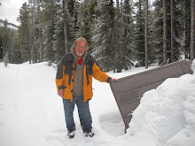
After Eaton Creek the trail leveled out considerably. Then about 2 hours into my walk I came to an old burn area. This area seems like the place that I was at in the summer of 1973. I can imagine that the mature scattered aspen trees, there now, were just saplings in 1973. I took the photo in that area.
The area seems to be dry but by afternoon there were some thunderstorms brewing and it did sprinkle rain on me a bit. Not enough to require rain gear. I noted a number of wild flowers in bloom. Wild Strawberry, Dandelion of course, Wood Violet, Blue Eyed Grass, Saskatoon, Purple Violet, False Solomon's Seal, Bain Berry, Lung Wort, and some Peavines and Vetches.
In the interest of time I only allowed myself 2 hours to walk in so I was able to get down the trail 7 km before I turned back. The furthest point that I reached was Henrietta Creek. It was about 1:15PM when I turned back. Although I did not observe any Elk it is likely only because I wasn't looking closely enough. I think this because east of Henrietta Creek the trail was covered with Elk tracks and there was fresh urine also. I could smell them. I expect that they saw me before I saw them and so they move off just as I arrived on the scene.
On the way in I noticed that there was no sign of bears on the trail. On the way out just east of the old burn area there was a big pile of bear poop on the trail. I am sure that if I had taken the temperature of the poop that it would have measured close to the body temperature of the bear.
And so I decided that it was a good time for me to be making a little more noise as I walked along. A bit further along I saw a Ruff Grouse. I think it was a female and that she had a nest or chicks nearby because she wasn't moving far. As I approached she ruffled her feathers and even made a couple of charges at me. "A lot of pluck in that mother" I thought. I'm just happy it was a momma grouse charging at me and not a momma bear.
So this bit of a hike got me within 49.2 km of Intersection Mountain but better than that I got to revisit an area that I had been to decades before.
Stats:
Total distance about 14 km
Total time about 4 hours.
My moving average 3.8.km/hr.
Maximum elevation was 3511 feet.
Total evelation gain was 727 feet.

No comments:
Post a Comment